Fiery Gizzard Trail
A rugged 9.5-mile round trip from Grundy Forest to the Raven Point overlook, past waterfalls, cascades, and boulder-strewn gorges.
Record this hike live
Recording keeps going as you move between screens, even with the screen off. Finish or Discard stops it.
- Length
- 9.5 mi
- Elevation gain
- 1,290 ft
- Difficulty
- hard
- Route
- out-and-back
Trail conditions
No recent condition reports. Hiked it lately?
Report current conditions →Elevation
8.9 mi · 455 ft of climbing · high 1,893 ft · low 1,675 ft
Find the trailhead
Parking
Grundy Forest trailhead, 131 Fiery Gizzard Road, Tracy City; free. The footing is rocky, so an early start and sturdy shoes help.
Directions to parkingWeather at the trailhead
72°FOvercast now
Sunrise 5:51 AM · Sunset 7:47 PM
- TodayOvercast83° / 62°F2% precip
- SatRain showers78° / 70°F48% precip
- SunDrizzle73° / 62°F64% precip
Forecast from Open-Meteo. Mountain conditions change fast; check again before you go.
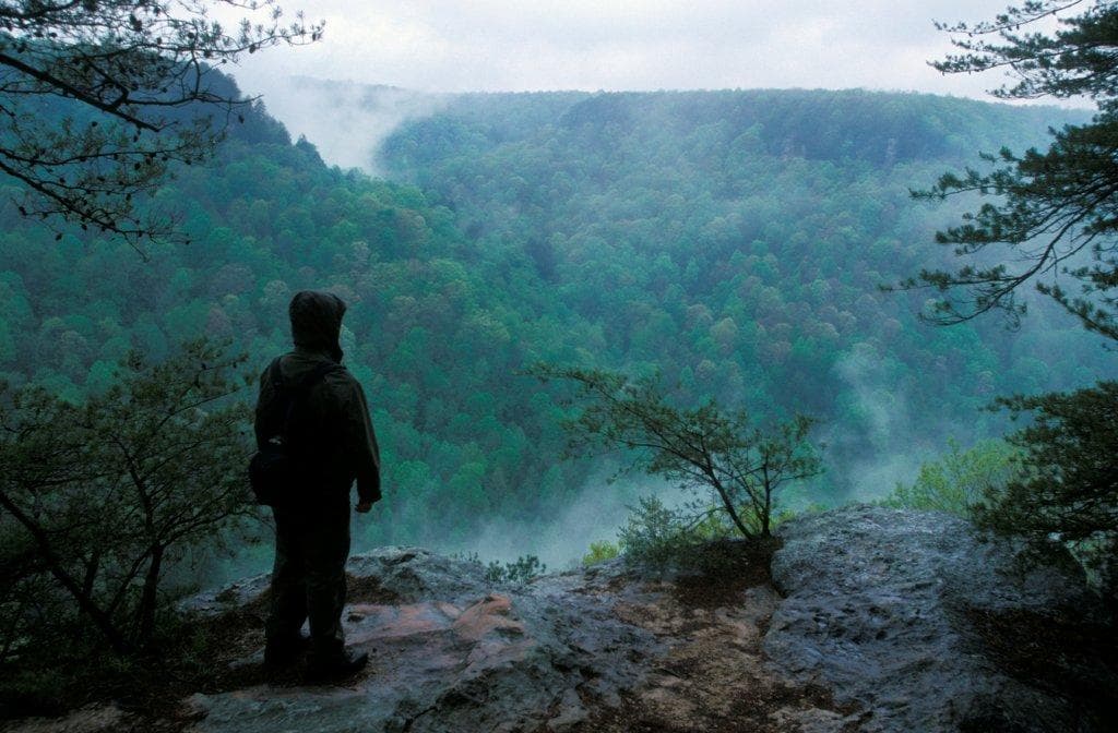
From the Grundy Forest trailhead the route follows cascading creeks past Blue Hole and Sycamore Falls before climbing onto the Cumberland Plateau rim. A short spur near the turnaround reaches Raven Point, a rocky promontory with a wide view over the gorge. Often ranked among the best hikes in the state, it is long and rugged the whole way.