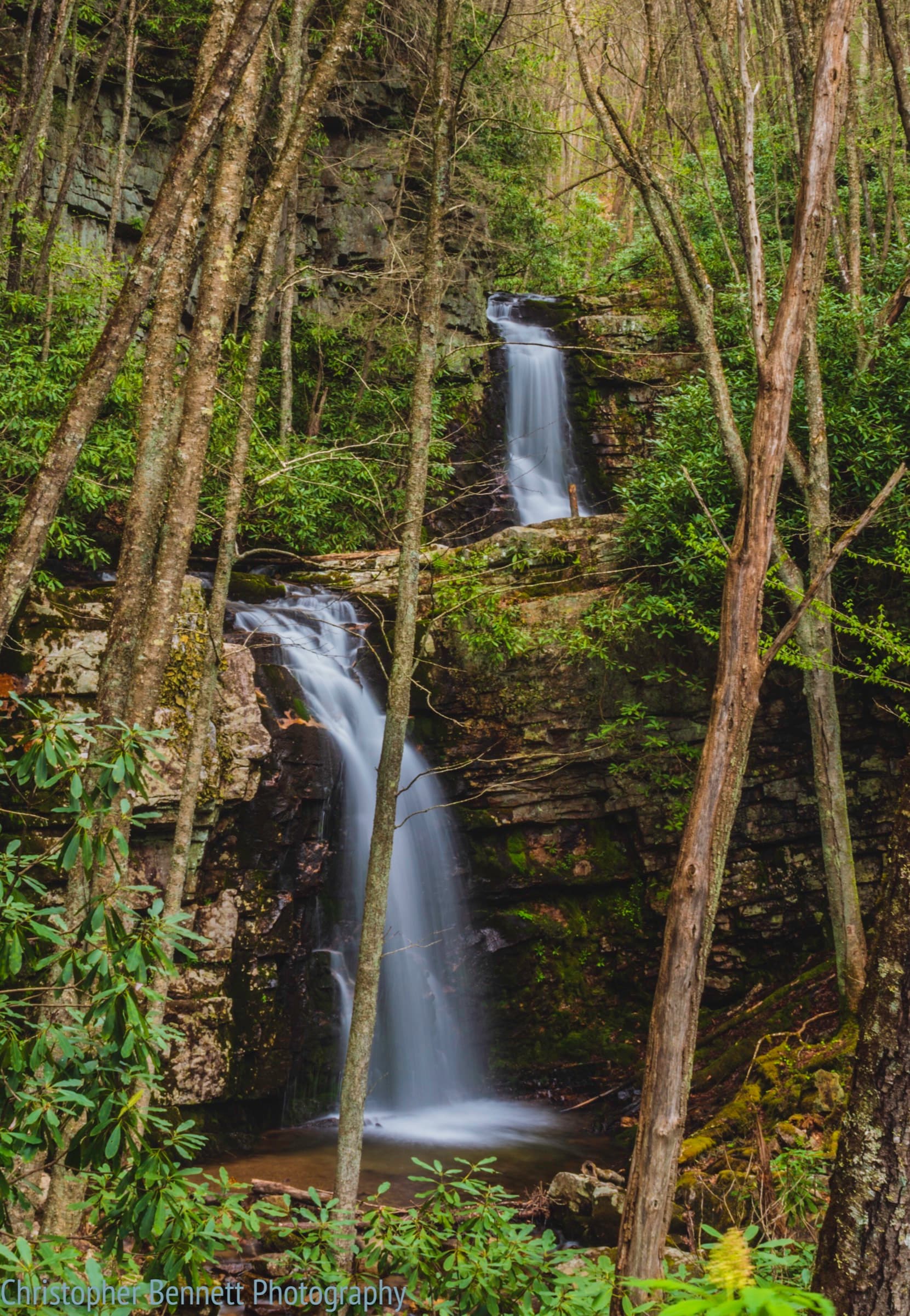
Gentry Creek Falls
A remote 4.6-mile round trip up a shaded valley with roughly 14 stepping-stone creek crossings, ending at a two-tiered 60-foot double waterfall near Laurel Bloomery.
Record this hike live
Recording keeps going as you move between screens, even with the screen off. Finish or Discard stops it.
- Length
- 4.6 mi
- Elevation gain
- 1,355 ft
- Difficulty
- moderate
- Route
- out-and-back
Trail conditions
Caution ·
Access roads to this remote trailhead were damaged by Hurricane Helene in 2024; check the Cherokee National Forest alerts page for current road and trail status before going.
Official notice
No recent condition reports. Hiked it lately?
Report current conditions →Elevation
2.5 mi · 633 ft of climbing · high 4,261 ft · low 3,734 ft
Find the trailhead
Parking
Dead-end gravel trailhead at the end of Gentry Creek Road; free, no facilities. The crossings can be impassable after heavy rain.
Directions to parkingWeather at the trailhead
67°FPartly cloudy now
Sunrise 6:32 AM · Sunset 8:34 PM
- TodayOvercast77° / 55°F0% precip
- SatOvercast80° / 63°F24% precip
- SunThunderstorm81° / 65°F62% precip
Forecast from Open-Meteo. Mountain conditions change fast; check again before you go.
Gentry Creek Falls Trail climbs gently along Gentry Creek for about 2.3 miles, fording the stream more than a dozen times before arriving at the secluded two-tier falls, where the lower drop spreads over a broad rock face. A narrow, dangerous scramble reaches the upper tier, but most hikers stay at the base. There is no potable water or restroom at the trailhead.