Greeter Falls Loop
A short loop on the Savage Gulf south side to the twin drops of Greeter Falls, where a steel spiral staircase corkscrews down the cliff to the 50-foot lower falls.
Record this hike live
Recording keeps going as you move between screens, even with the screen off. Finish or Discard stops it.
- Length
- 1.7 mi
- Elevation gain
- 470 ft
- Difficulty
- moderate
- Route
- loop
Trail conditions
No recent condition reports. Hiked it lately?
Report current conditions →Elevation
1.6 mi · 469 ft of climbing · high 1,841 ft · low 1,585 ft
Find the trailhead
Parking
Free gravel lot at the Greeter Falls trailhead off Greeter Falls Road near Altamont; it is modest in size and overflows on spring weekends, with the Alum Gap hikers sharing the same lot.
Directions to parkingWeather at the trailhead
80°FClear now
Sunrise 5:48 AM · Sunset 7:50 PM
- TodayOvercast88° / 71°F11% precip
- WedOvercast84° / 69°F4% precip
- ThuPartly cloudy84° / 61°F0% precip
Forecast from Open-Meteo. Mountain conditions change fast; check again before you go.
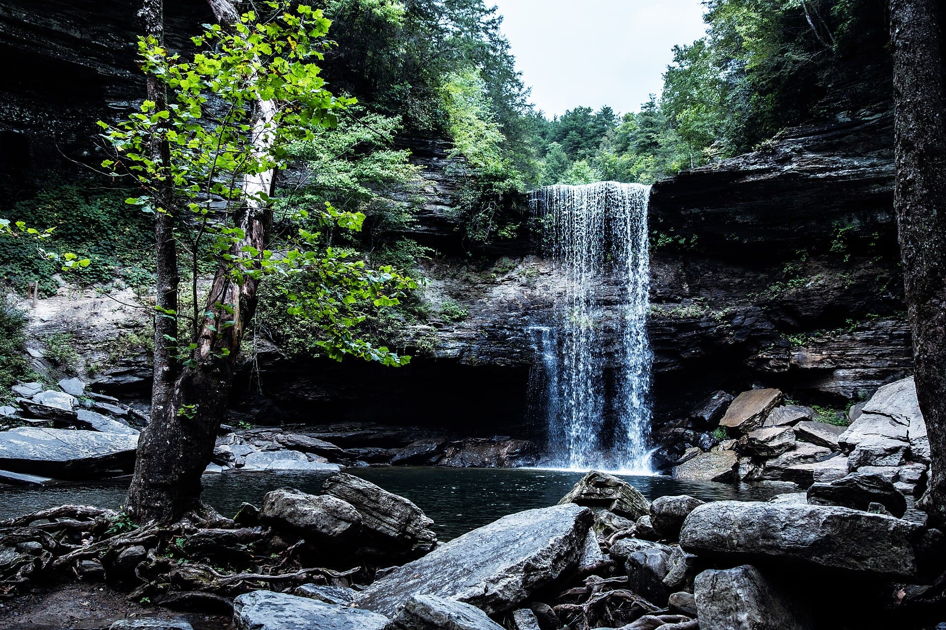
Greeter Falls delivers a remarkable amount of drama for under two miles of walking: Firescald Creek pours over a 15-foot upper ledge, slides across a rock shelf, and then plunges 50 feet into one of the prettiest blue-green pools on the plateau. From the trailhead the Greeter Trail runs an easy half mile through hardwoods to the loop split; go right for the upper falls first, then double back for the lower falls spur, where the route descends a slot in the bluff on a steel spiral staircase bolted to the cliff — sturdy, but wet, steep, and not for anyone carrying a squirming dog or toddler. The final approach to the pool crosses jumbled, slick boulders, and the current below the falls is stronger than it looks. The adjacent Blue Hole Trail adds a short side trip to a popular swimming hole on the same creek. This is now part of Savage Gulf State Park, split from South Cumberland in 2022, and remains free day-use.