Holston Mountain Fire Tower
A short out-and-back on the gated, gravel Holston Mountain Trail to the historic Holston High Knob fire lookout tower at about 4,136 feet.
Record this hike live
Recording keeps going as you move between screens, even with the screen off. Finish or Discard stops it.
- Length
- 2.4 mi
- Elevation gain
- 390 ft
- Difficulty
- moderate
- Route
- out-and-back
Trail conditions
No recent condition reports. Hiked it lately?
Report current conditions →Elevation
3.2 mi · 438 ft of climbing · high 4,137 ft · low 3,379 ft
Find the trailhead
Parking
Backcountry lot at the gate (junction of Forest Service roads 56, 56A, and 202) near Elizabethton; free. A smooth, gentle gravel grade.
Directions to parkingWeather at the trailhead
67°FPartly cloudy now
Sunrise 6:34 AM · Sunset 8:35 PM
- TodayOvercast71° / 52°F1% precip
- SatOvercast72° / 61°F27% precip
- SunRain showers78° / 61°F60% precip
Forecast from Open-Meteo. Mountain conditions change fast; check again before you go.
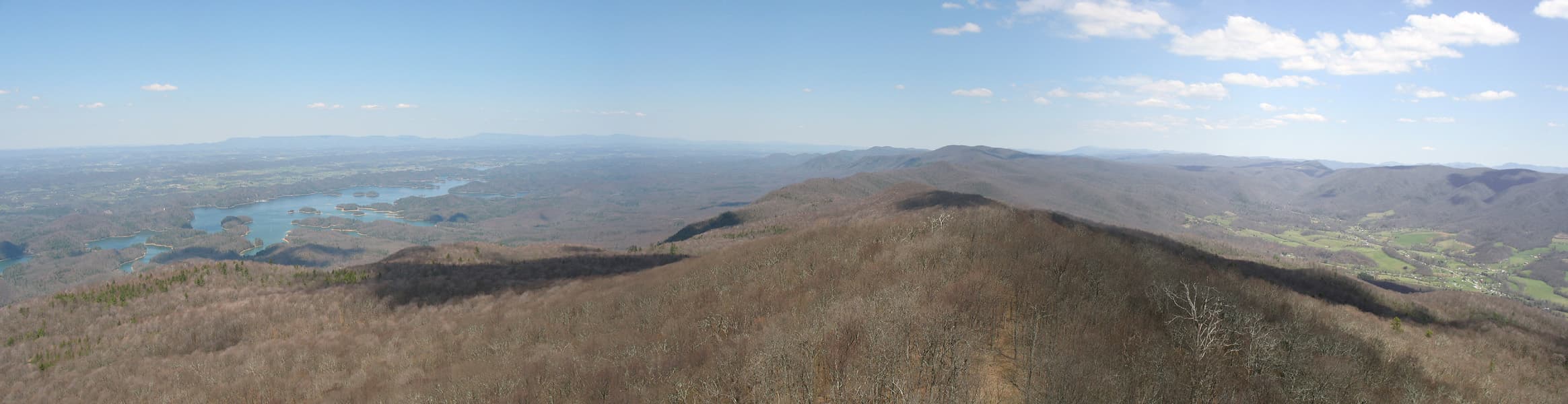
From the gate, the blue-blazed Holston Mountain Trail climbs a packed-gravel old roadbed roughly 1.2 miles to the Holston High Knob fire tower. The steel tower, now fenced and weathered, once watched over the Cherokee National Forest and still anchors broad ridge-top views toward South Holston Lake and Virginia. This is the gentlest way to the lookout; the alternative Flint Mill approach is a much steeper climb.