Laurel Fork Falls
A 2.2-mile round trip on the Appalachian Trail from Dennis Cove into the Laurel Fork Gorge of the Pond Mountain Wilderness, ending at the 55-foot plunge of Laurel Fork Falls.
Record this hike live
Recording keeps going as you move between screens, even with the screen off. Finish or Discard stops it.
- Length
- 2.2 mi
- Elevation gain
- 640 ft
- Difficulty
- moderate
- Route
- out-and-back
Trail conditions
- Muddy · · Out of date “Slightly muddy from morning rains”
Elevation
1.1 mi · 118 ft of climbing · high 2,504 ft · low 2,099 ft
Find the trailhead
Parking
Small gravel AT trailhead pull-off where the Appalachian Trail crosses Dennis Cove Road (FS 50) above Hampton; the lot holds only a handful of cars and the paved road up from US 321 is steep and winding.
Directions to parkingWeather at the trailhead
76°FOvercast now
Sunrise 6:32 AM · Sunset 8:37 PM
- TodayRain showers81° / 71°F50% precip
- WedFog75° / 65°F10% precip
- ThuClear78° / 56°F1% precip
Forecast from Open-Meteo. Mountain conditions change fast; check again before you go.
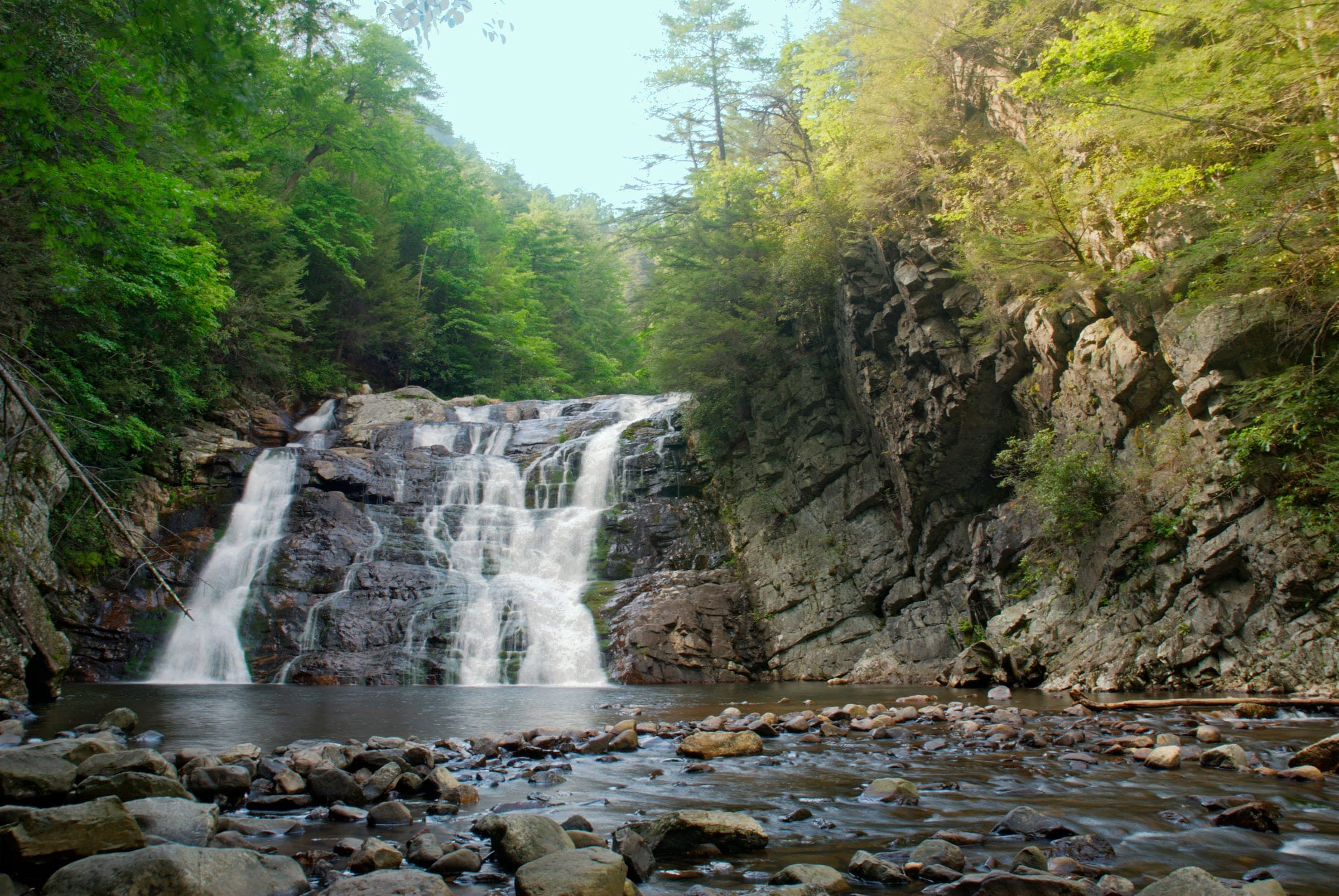
Laurel Fork Falls — locally just Laurel Falls, not to be confused with the paved Smokies walk of the same name — is the centerpiece of the Laurel Fork Gorge in the Pond Mountain Wilderness, and the Appalachian Trail delivers you to it from the Dennis Cove trailhead in barely over a mile. The white-blazed route follows an old railroad grade along the rushing creek, crosses it on footbridges between mossy cliff walls, then breaks right to descend a steep, blasted rock staircase to the base, where the falls pound 55 feet into a broad pool. That staircase is the crux: the stone steps are uneven and stay wet, and the pool below has taken lives — swimmers have been pulled under by the recirculating current at the base, so wade the tail-out, not the plunge pool. At high water the riverside route past the falls floods, which is why a blue-blazed high-water bypass climbs over the ridge; day hikers to the falls can simply turn back the way they came. Expect company on warm weekends, both from Hampton-side hikers coming up the blue-blazed blueline trail and from AT thru-hikers in spring, and leave the tiny Dennis Cove lot early.