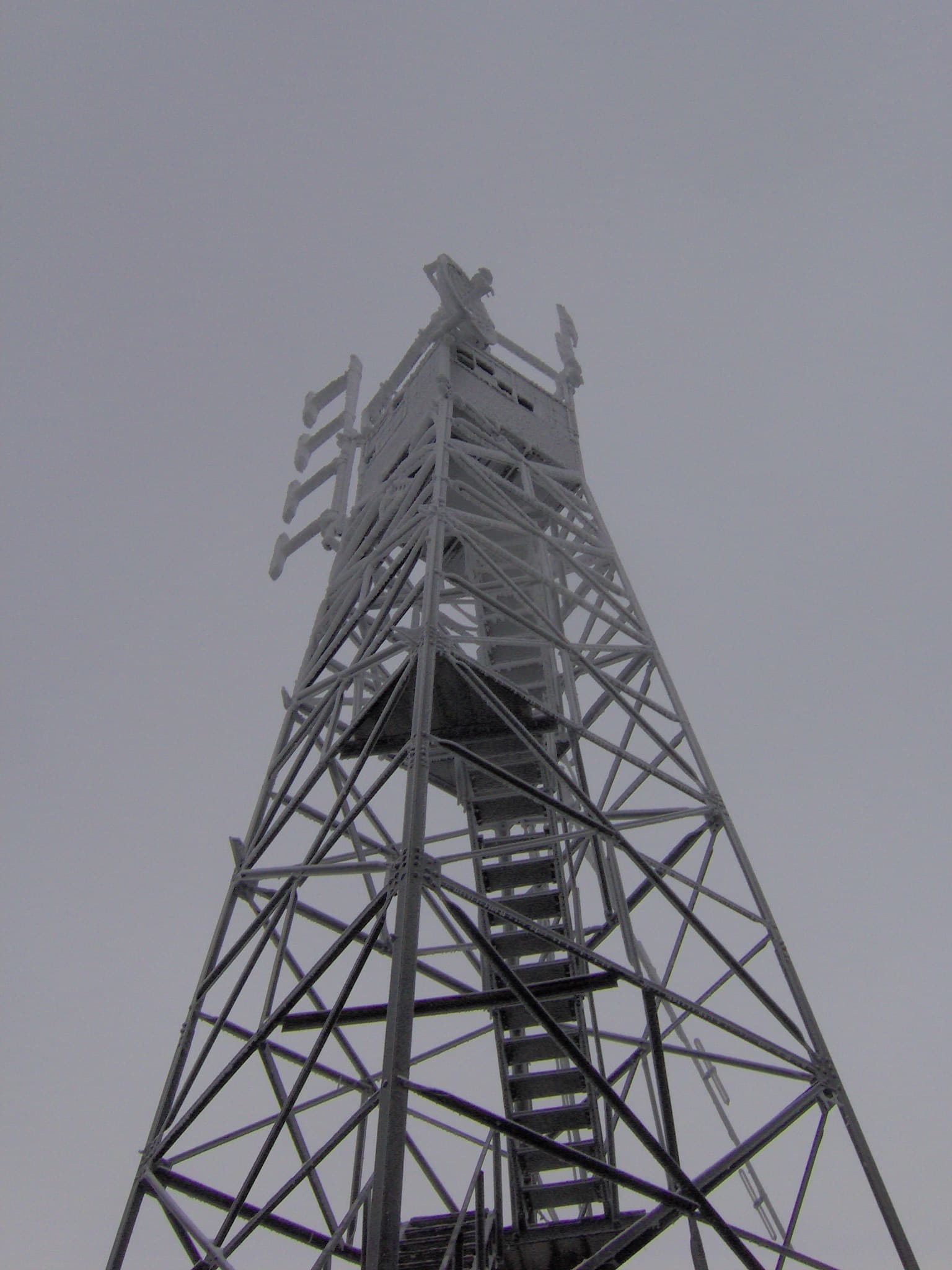
Mount Sterling
A brutally steep 12.2-mile round trip up the Baxter Creek Trail from Big Creek, climbing about 4,100 feet to the Mount Sterling summit and its 1935 fire tower.
Record this hike live
Recording keeps going as you move between screens, even with the screen off. Finish or Discard stops it.
- Length
- 12.2 mi
- Elevation gain
- 4,100 ft
- Difficulty
- strenuous
- Route
- out-and-back
Trail conditions
No recent condition reports. Hiked it lately?
Report current conditions →Elevation
5.5 mi · 4,144 ft of climbing · high 5,838 ft · low 1,694 ft
Find the trailhead
Parking
Big Creek picnic area footbridge; a Great Smoky Mountains parking tag is required. Carry plenty of water; sources are low and the high summit is cold. Pets are not allowed on park trails.
Directions to parkingWeather at the trailhead
74°FClear now
Sunrise 6:39 AM · Sunset 8:37 PM
- TodayOvercast85° / 63°F2% precip
- SatDrizzle88° / 68°F39% precip
- SunRain showers89° / 67°F58% precip
Forecast from Open-Meteo. Mountain conditions change fast; check again before you go.
The Baxter Creek Trail starts at the footbridge over Big Creek and climbs almost relentlessly for about six miles, gaining over 4,000 feet through cove hardwoods and into spruce-fir forest, one of the toughest day hikes in the park. The reward is the restored 60-foot CCC fire tower at the summit, the highest standing fire tower in the Smokies, with a 360-degree view from its cab.