Pinson Mounds Loop
A flat loop through the largest Middle Woodland mound complex in North America, passing 72-foot Sauls Mound and a bottomland boardwalk south of Jackson.
Record this hike live
Recording keeps going as you move between screens, even with the screen off. Finish or Discard stops it.
- Length
- 2.5 mi
- Elevation gain
- 195 ft
- Difficulty
- easy
- Route
- loop
Trail conditions
No recent condition reports. Hiked it lately?
Report current conditions →Elevation
2.4 mi · 195 ft of climbing · high 456 ft · low 380 ft
Find the trailhead
Parking
Free paved lot at the mound-shaped museum and visitor center off Ozier Road; gates close in the evening, so check posted park hours.
Directions to parkingWeather at the trailhead
85°FMainly clear now
Sunrise 6:00 AM · Sunset 8:02 PM
- TodayOvercast97° / 76°F6% precip
- WedRain showers90° / 74°F18% precip
- ThuMainly clear87° / 66°F1% precip
Forecast from Open-Meteo. Mountain conditions change fast; check again before you go.
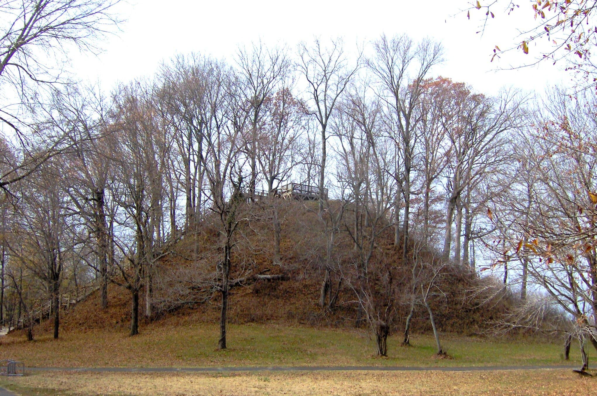
Pinson Mounds protects at least 15 earthen mounds raised by Middle Woodland people roughly 1,800 to 2,000 years ago, and this loop strings the highlights together on wide, nearly flat grass and dirt paths. From the mound-shaped museum the trail crosses open field to Sauls Mound, at 72 feet the second-tallest surviving prehistoric mound in the United States, with a wooden stair platform partway up; the stairs are the only real climb of the day. South of the central mound group a boardwalk drops into the Forked Deer River bottomland, where cypress and mud flats hold standing water much of the year. There is almost no shade across the field sections, so summer hikes mean full sun, heat, and ticks in the taller grass; winter and early spring are the comfortable seasons. Stay off the mounds themselves except where stairs are provided, as they are protected archaeological features.