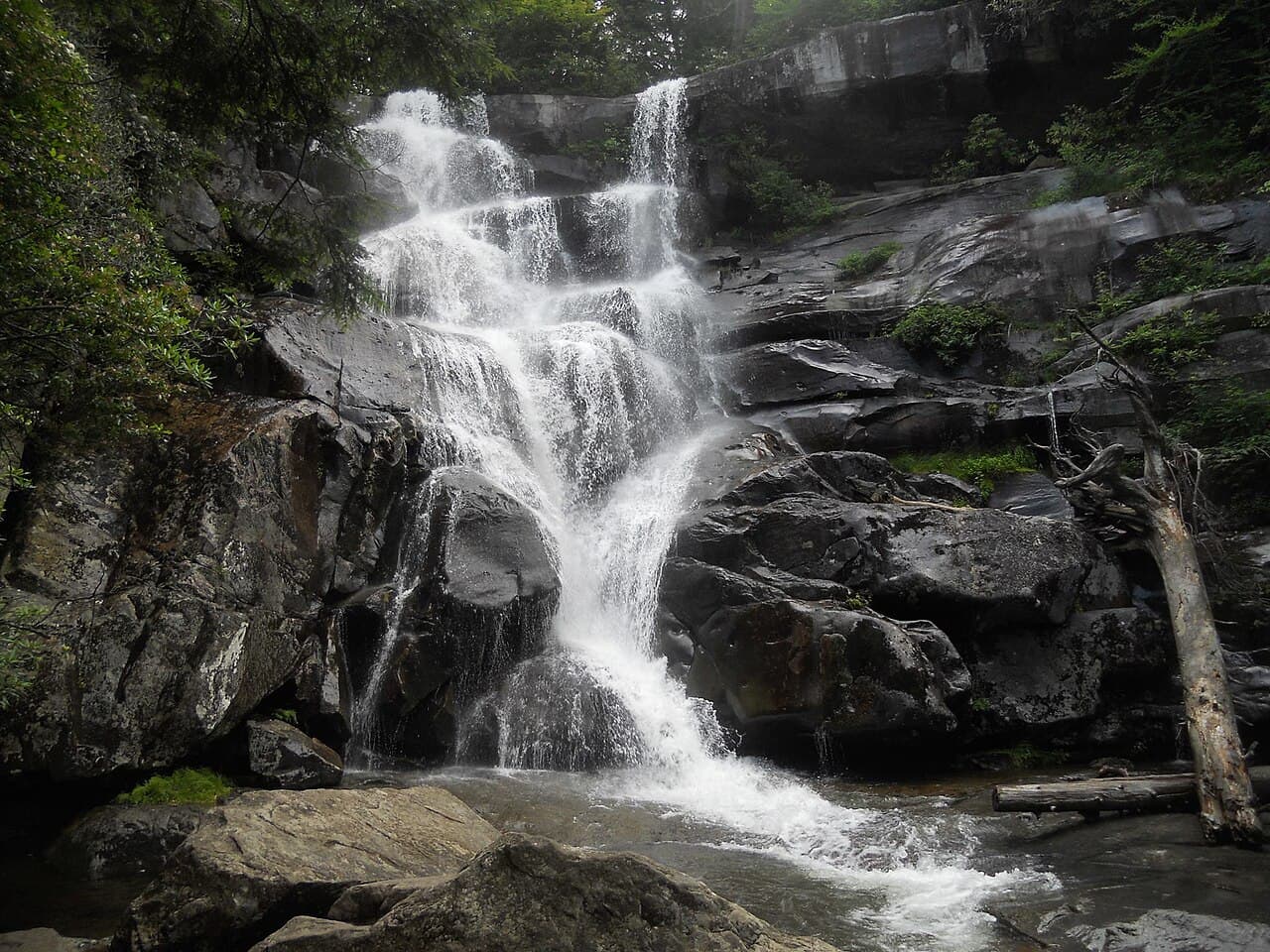
Ramsey Cascades
A demanding 8-mile round trip up the Ramsey Prong through towering old-growth forest to the 100-foot Ramsey Cascades, the tallest waterfall in the Smokies.
Record this hike live
Recording keeps going as you move between screens, even with the screen off. Finish or Discard stops it.
- Length
- 8 mi
- Elevation gain
- 2,200 ft
- Difficulty
- strenuous
- Route
- out-and-back
Trail conditions
No recent condition reports. Hiked it lately?
Report current conditions →Elevation
3.6 mi · 2,204 ft of climbing · high 4,267 ft · low 2,075 ft
Find the trailhead
Parking
Trailhead lot at the end of the gravel Ramsey Prong Road in the Greenbrier area; the road is rough and fills early.
Directions to parkingWeather at the trailhead
82°FClear now
Sunrise 6:38 AM · Sunset 8:41 PM
- TodayRain showers86° / 74°F53% precip
- WedOvercast80° / 71°F25% precip
- ThuOvercast80° / 60°F17% precip
Forecast from Open-Meteo. Mountain conditions change fast; check again before you go.
Ramsey Cascades is the tallest waterfall in Great Smoky Mountains National Park, dropping roughly 100 feet over a series of rock ledges. Getting there is the hard part: the trail climbs about 2,200 feet over four miles, the last mile and a half rough and rocky as it follows the Ramsey Prong up through one of the finest stands of old-growth hardwood forest in the East. Giant tulip poplars, silverbells, and basswoods tower over the path. The rocks at the base are slick and have caused fatal falls; enjoy the cascade from a safe distance and do not climb. A parking tag is required park-wide.