Rich Mountain Loop
A strenuous 8.5-mile loop above Cades Cove that climbs Rich Mountain to the old fire-tower site and a string of overlooks down into the cove.
Record this hike live
Recording keeps going as you move between screens, even with the screen off. Finish or Discard stops it.
- Length
- 8.5 mi
- Elevation gain
- 1,736 ft
- Difficulty
- strenuous
- Route
- loop
Trail conditions
No recent condition reports. Hiked it lately?
Report current conditions →Elevation
9.3 mi · 3,182 ft of climbing · high 3,342 ft · low 1,899 ft
Find the trailhead
Parking
Lot at the entrance to the one-way Cades Cove Loop Road; a Great Smoky Mountains parking tag is required. Pets are not allowed on park trails.
Directions to parkingWeather at the trailhead
83°FOvercast now
Sunrise 6:42 AM · Sunset 8:40 PM
- TodayOvercast84° / 63°F1% precip
- SatRain80° / 70°F49% precip
- SunRain85° / 66°F45% precip
Forecast from Open-Meteo. Mountain conditions change fast; check again before you go.
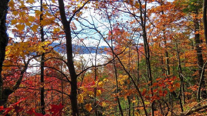
From the lot at the start of the Cades Cove Loop Road, the route stays nearly flat for the first mile and a half before climbing hard up Indian Grave Gap and Crooked Arm Ridge, gaining roughly 1,700 feet. A faint side path near mile four leads to Cerulean Knob, the highest point on Rich Mountain, where concrete pillars from the former fire tower remain. The ridge gives the best views down into Cades Cove during the leaf-off months.