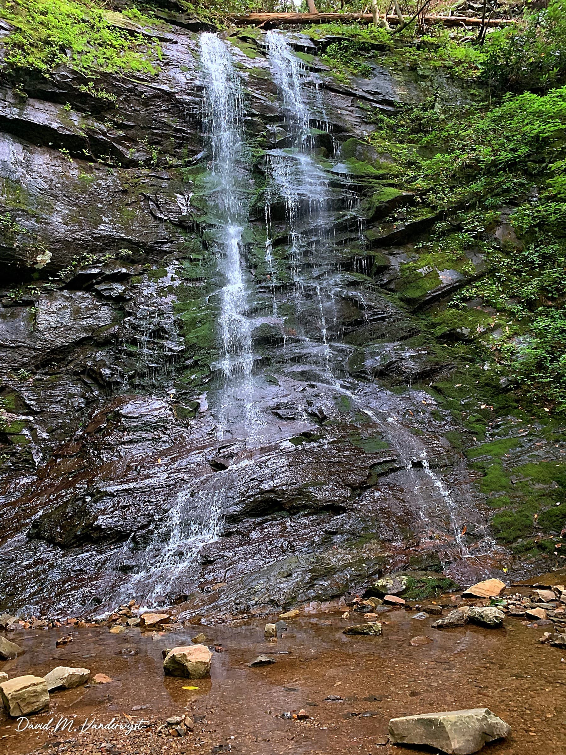
Sill Branch Falls
A short, easy walk up a hemlock-and-rhododendron cove along Sill Branch to a 20-foot waterfall with a water-play area at its base.
Record this hike live
Recording keeps going as you move between screens, even with the screen off. Finish or Discard stops it.
- Length
- 1.1 mi
- Elevation gain
- 272 ft
- Difficulty
- easy
- Route
- out-and-back
Trail conditions
No recent condition reports. Hiked it lately?
Report current conditions →Elevation
0.5 mi · 281 ft of climbing · high 2,032 ft · low 1,751 ft
Find the trailhead
Parking
Trailhead off Clark Creek Road (NFSR 25) near Greeneville; free, parking for 4-6 vehicles. No restrooms or potable water.
Directions to parkingWeather at the trailhead
75°FOvercast now
Sunrise 6:37 AM · Sunset 8:35 PM
- TodayRain78° / 69°F29% precip
- SunRain showers85° / 72°F63% precip
- MonRain showers87° / 66°F68% precip
Forecast from Open-Meteo. Mountain conditions change fast; check again before you go.
From the Clark Creek Road trailhead, the path follows clear Sill Branch up a deep mountain cove, crossing the stream before a brief steep pitch to the falls. The 20-foot cascade and its pool make a popular family destination, with the strongest flow in spring and fall. Pack animals are not allowed.