Stillhouse Hollow Falls Trail
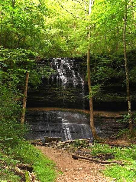
A short but steep hike down to a 75-foot waterfall in a small state natural area near Summertown.
Record this hike live
Recording keeps going as you move between screens, even with the screen off. Finish or Discard stops it.
- Length
- 1.2 mi
- Elevation gain
- 220 ft
- Difficulty
- moderate
- Route
- out-and-back
Trail conditions
No recent condition reports. Hiked it lately?
Report current conditions →Elevation
0.7 mi · 89 ft of climbing · high 966 ft · low 748 ft
Find the trailhead
Parking
Small gravel lot off US-43 holding only 10 to 15 cars; when full the area is at capacity, so arrive early.
Directions to parkingWeather at the trailhead
75°FClear now
Sunrise 5:57 AM · Sunset 7:53 PM
- TodayFog87° / 64°F9% precip
- SatDrizzle88° / 71°F40% precip
- SunDrizzle78° / 64°F39% precip
Forecast from Open-Meteo. Mountain conditions change fast; check again before you go.
The trail descends through hardwood forest over rocks, roots, stairs, and small bridges, crossing a shallow stream to reach the falls about two-thirds of a mile in. An unnamed tributary forms small cascades before plunging roughly 75 feet over the bluff into a pool popular as a swimming hole. The return is the steep climb back out.