Boundary Trail
A flat 3.3-mile loop tracing the wooded perimeter of the Stones River battlefield, linking the main tour stops, cedar glades, and the 1863 Hazen Brigade Monument.
Record this hike live
Recording keeps going as you move between screens, even with the screen off. Finish or Discard stops it.
- Length
- 3.3 mi
- Elevation gain
- 80 ft
- Difficulty
- easy
- Route
- loop
Trail conditions
No recent condition reports. Hiked it lately?
Report current conditions →Elevation
3.3 mi · 77 ft of climbing · high 587 ft · low 548 ft
Find the trailhead
Parking
Stones River National Battlefield visitor center near Murfreesboro; free, no entrance fee. Leashed pets are welcome.
Directions to parkingWeather at the trailhead
80°FOvercast now
Sunrise 5:52 AM · Sunset 7:51 PM
- TodayOvercast89° / 63°F14% precip
- SatDrizzle87° / 73°F42% precip
- SunOvercast77° / 67°F58% precip
Forecast from Open-Meteo. Mountain conditions change fast; check again before you go.
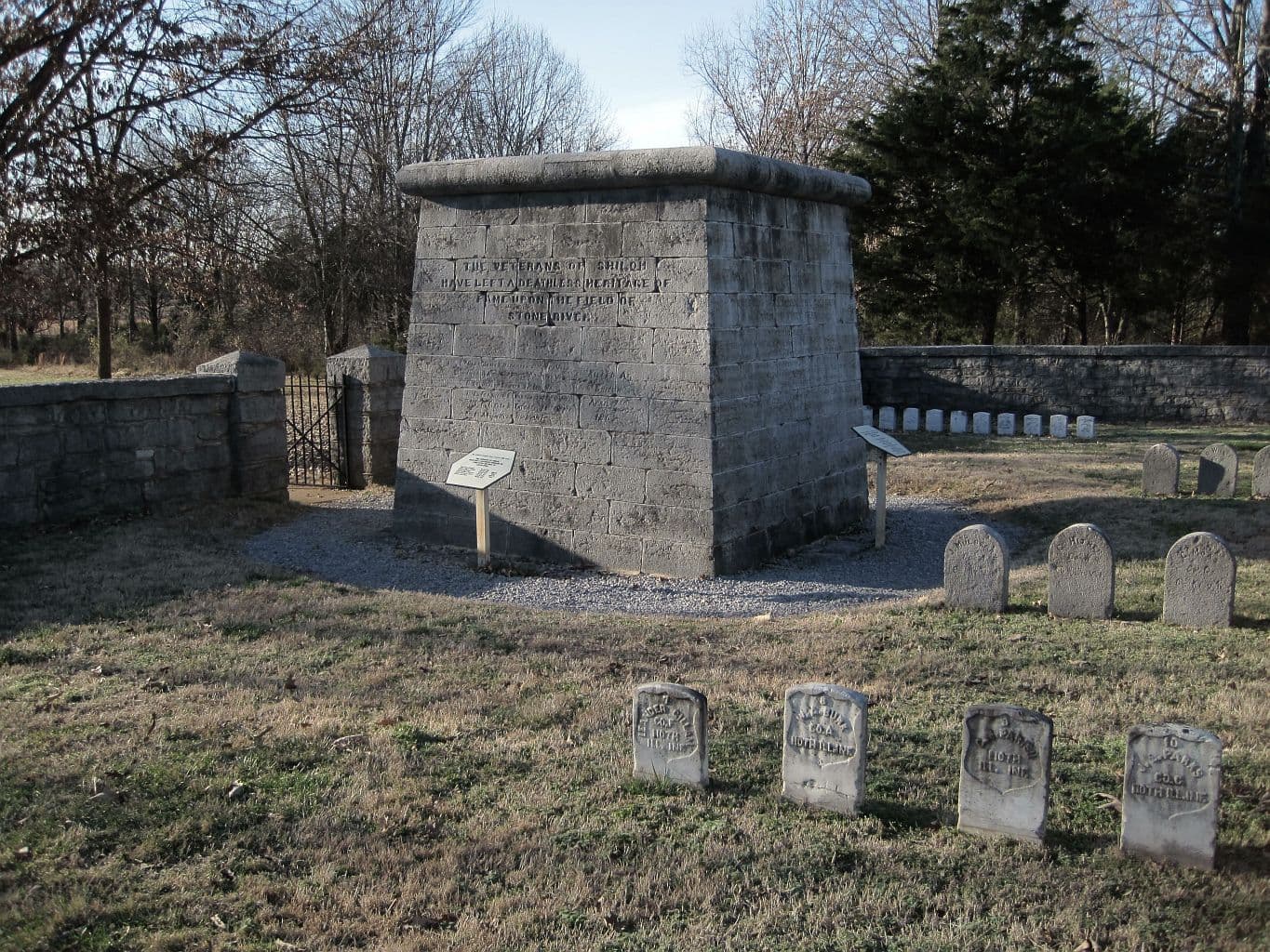
The Boundary Trail loops around the edge of the park through second-growth cedar and hardwood, connecting the battlefield's main features without the car traffic of the tour road. It passes the Hazen Brigade Monument, raised by soldiers in 1863 and thought to be the oldest intact Civil War monument, along with the National Cemetery and the rocky cedar glades that shaped the fighting here in the winter of 1862 to 1863. The grade is nearly flat, making the full loop a long but easy walk.