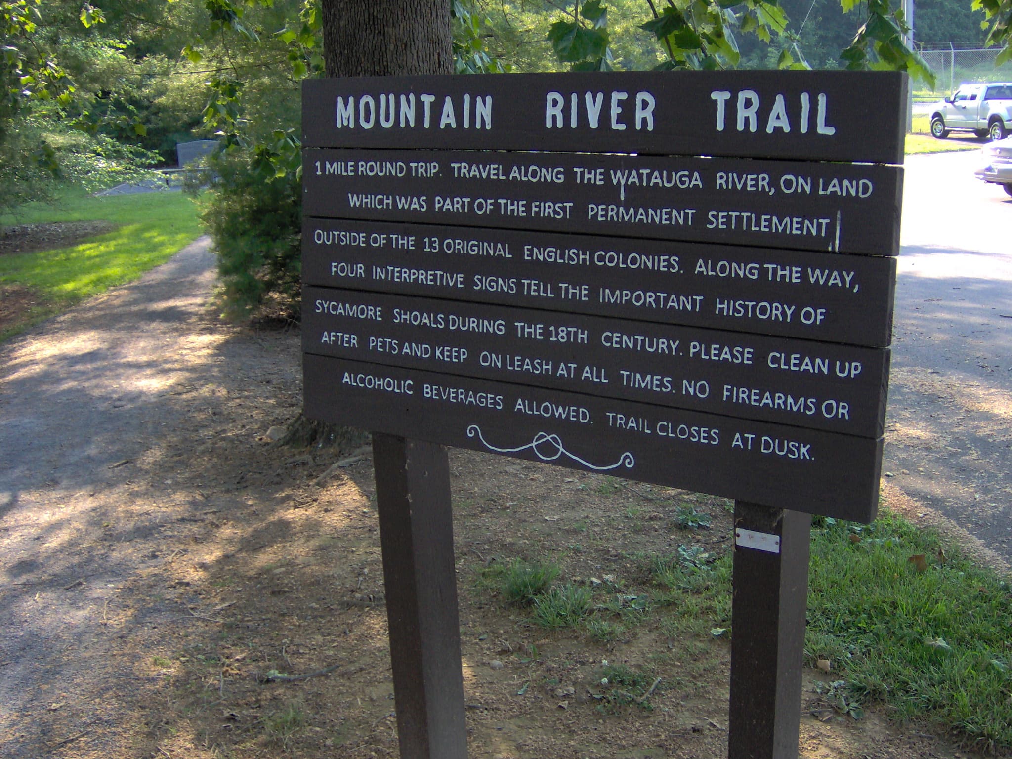
Sycamore Shoals Nature Trail
An easy, nearly flat 1-mile riverside walk along the Watauga River through the Revolutionary War-era Sycamore Shoals, where the Overmountain Men mustered in 1780.
Record this hike live
Recording keeps going as you move between screens, even with the screen off. Finish or Discard stops it.
- Length
- 2.5 mi
- Elevation gain
- 30 ft
- Difficulty
- easy
- Route
- loop
Trail conditions
No recent condition reports. Hiked it lately?
Report current conditions →Elevation
2.5 mi · 114 ft of climbing · high 1,513 ft · low 1,461 ft
Find the trailhead
Parking
Visitor center lot at 1651 W Elk Avenue, Elizabethton; free. Fine-gravel path, flat and family-friendly.
Directions to parkingWeather at the trailhead
75°FOvercast now
Sunrise 6:35 AM · Sunset 8:35 PM
- TodayOvercast86° / 55°F0% precip
- SatOvercast86° / 69°F30% precip
- SunRain showers88° / 69°F60% precip
Forecast from Open-Meteo. Mountain conditions change fast; check again before you go.
The fine-gravel Patriot Path and adjoining Longhunter Loop trace the banks of the Watauga River past the shoals and the reconstructed Fort Watauga. It pairs river scenery with deep early-frontier history and ties into the Overmountain Victory National Historic Trail. Flat and shaded in stretches, it suits families and casual walkers year-round.