Twin Arches Loop
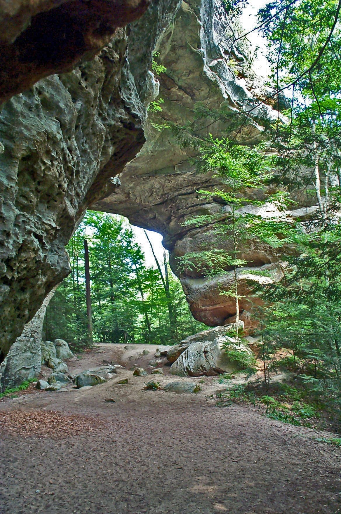
A 4.6-mile plateau loop in Big South Fork that drops past the massive North and South Arches, two of the largest natural bridges in the eastern United States, then circles the mesa beneath the bluff line.
Record this hike live
Recording keeps going as you move between screens, even with the screen off. Finish or Discard stops it.
- Length
- 4.6 mi
- Elevation gain
- 740 ft
- Difficulty
- moderate
- Route
- loop
Trail conditions
No recent condition reports. Hiked it lately?
Report current conditions →Elevation
3.8 mi · 740 ft of climbing · high 1,547 ft · low 984 ft
Find the trailhead
Parking
Gravel lot at the end of Twin Arches Road, reached by several miles of slow unpaved road off TN-154; no fee, vault toilet at the trailhead.
Directions to parkingWeather at the trailhead
81°FClear now
Sunrise 6:42 AM · Sunset 8:48 PM
- TodayDrizzle88° / 73°F17% precip
- WedOvercast81° / 68°F2% precip
- ThuOvercast83° / 58°F0% precip
Forecast from Open-Meteo. Mountain conditions change fast; check again before you go.
The Twin Arches are the showpiece of the Big South Fork plateau, a pair of enormous sandstone bridges standing end to end on a narrow ridge, and this loop earns them properly. From the trailhead the path runs nearly flat through upland pine and oak before dropping off the rim on long wooden staircases; you pass under the North Arch first, and a steeper stair climbs over the ridge between the two spans. Past the South Arch the loop continues down and around the mesa under a continuous bluff line, ducking past huge rock houses and the Jakes Place homesite before climbing back to close the circuit. The stairs are the only sustained work, but they are tall and can be icy in winter, and the cliff edges above the arches are unfenced, so keep children and dogs close on top. Hikers short on time can skip the lower loop and return from the arches for roughly a 1.4-mile round trip. The gravel approach on Twin Arches Road is rough washboard but fine for 2WD in dry weather.