Warriors' Path Overlook Trail
An easy ridgetop loop to bluff overlooks above the South Fork Holston River and Fort Patrick Henry Reservoir.
Record this hike live
Recording keeps going as you move between screens, even with the screen off. Finish or Discard stops it.
- Length
- 0.7 mi
- Elevation gain
- 65 ft
- Difficulty
- easy
- Route
- loop
Trail conditions
No recent condition reports. Hiked it lately?
Report current conditions →Elevation
0.7 mi · 132 ft of climbing · high 1,366 ft · low 1,295 ft
Along the trail
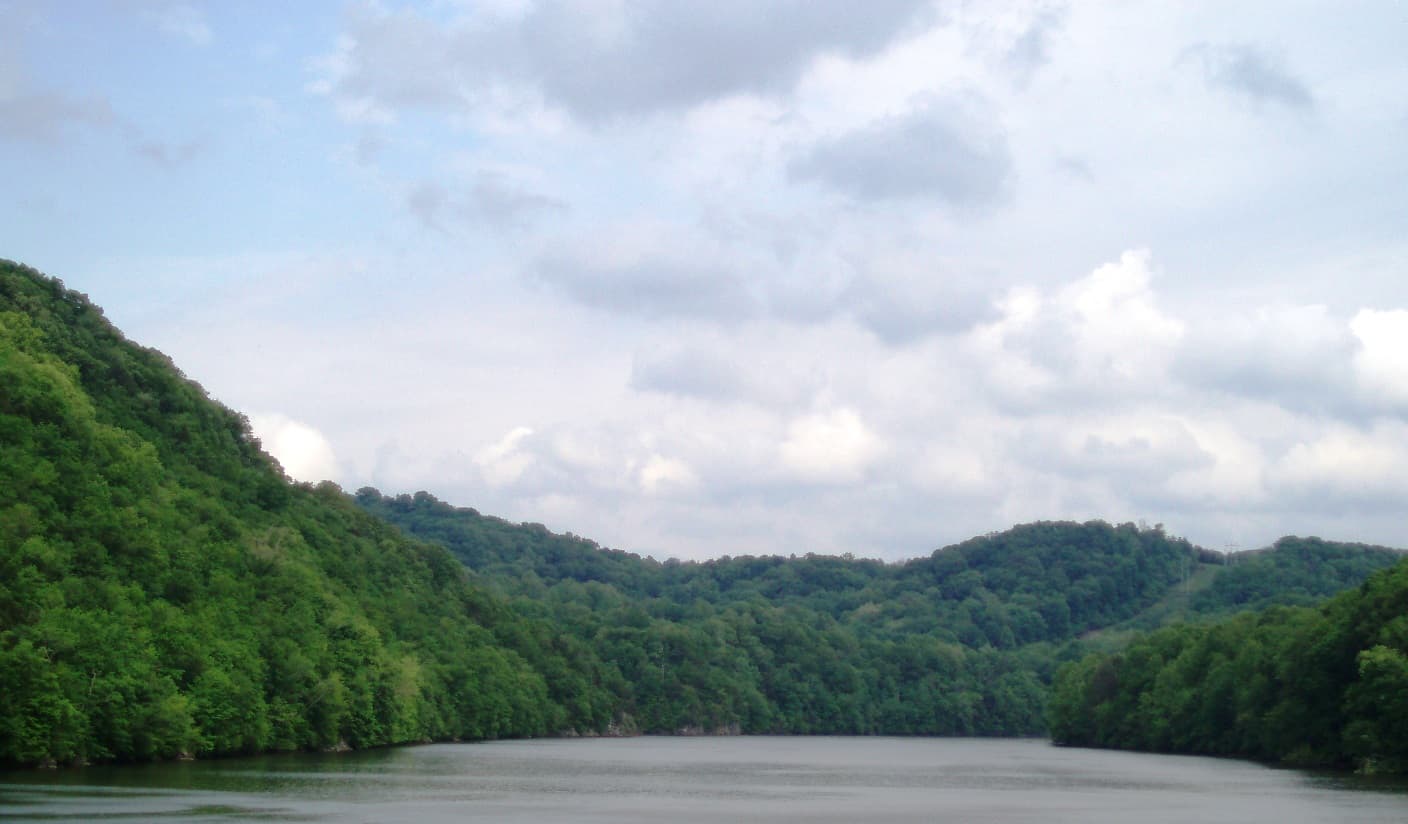
River Bluff Overlook · Viewpoint
Cliff-top view over the South Fork Holston River, with I-81 across the water.
Bluff edge · Caution
The bluff edges along the loop are unfenced. Keep children and dogs close.
Find the trailhead
Parking
Free gravel lot at the boat launch past the marina; the trailhead is at the far end.
Directions to parkingWeather at the trailhead
76°FOvercast now
Sunrise 6:33 AM · Sunset 8:39 PM
- TodayDrizzle87° / 71°F50% precip
- WedOvercast80° / 67°F2% precip
- ThuClear83° / 57°F0% precip
Forecast from Open-Meteo. Mountain conditions change fast; check again before you go.
A short ridgetop loop in Warriors' Path State Park, on a wooded peninsula above the South Fork Holston River. The trail leaves the boat launch on an old roadbed, climbs gently onto the ridge, and traces the bluff past overlooks of the river and Fort Patrick Henry Reservoir, with I-81 visible across the water. Side paths branch toward the lake, so follow the blazes at the forks. The bluff edges are unfenced, so keep children and dogs close. Dogs welcome on leash; no entry fees.