Window Cliffs
A rugged 5.5-mile round trip near Baxter with nine fords of Cane Creek, ending atop a knife-edge ridge pierced by natural-bridge "windows" 200 feet above the water.
Record this hike live
Recording keeps going as you move between screens, even with the screen off. Finish or Discard stops it.
- Length
- 5.5 mi
- Elevation gain
- 720 ft
- Difficulty
- hard
- Route
- out-and-back
Trail conditions
No recent condition reports. Hiked it lately?
Report current conditions →Elevation
2.5 mi · 298 ft of climbing · high 982 ft · low 668 ft
Find the trailhead
Parking
Small free gravel lot at the end of Window Cliffs Road south of Baxter, managed by Burgess Falls State Park; day-use only with a gate locked at posted hours, and the area closes entirely when Cane Creek runs high.
Directions to parkingWeather at the trailhead
83°FClear now
Sunrise 5:46 AM · Sunset 7:50 PM
- TodayOvercast92° / 75°F12% precip
- WedPartly cloudy87° / 71°F2% precip
- ThuOvercast80° / 61°F0% precip
Forecast from Open-Meteo. Mountain conditions change fast; check again before you go.
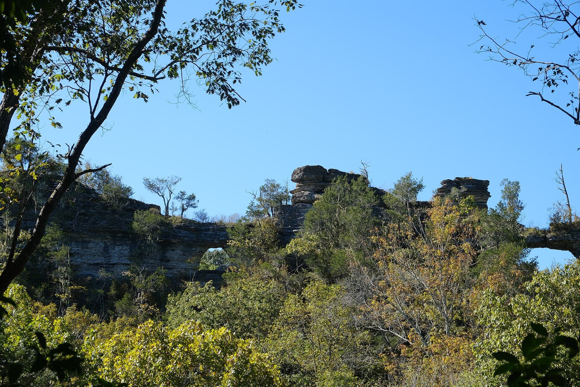
Window Cliffs is one of Middle Tennessee's strangest landforms: Cane Creek doubles back on itself around a 200-foot limestone ridge so narrow that erosion has punched clean through it, leaving open "windows" in the rock spine. Earning the view takes work — the trail drops steeply off the parking ridge, then fords Cane Creek nine times before climbing to the crest, and none of the crossings are bridged. Expect wet feet at the best of times, knee-deep wades in spring, and bring trekking poles and shoes you can soak; the state closes the natural area outright when the creek is in flood, so check Burgess Falls State Park's status before driving out. On top, the path runs along the exposed, unfenced spine of the cliffs with steep drops on both sides, a place for careful feet rather than scrambling kids. Wildflowers along the creek bottoms are excellent in April, and summer hikers should start early since the open cedar glades on the ridge bake in the afternoon.